Maitland’s High Street
Ever wondered why Maitland’s High St is aligned as it is and why it is seemingly level for much of its distance?
The origins of Maitland’s main street go back to the earliest days of European settlement when Maitland was the jumping-off point for those headed for the upper Hunter, the squatting leases of the Liverpool and western plains and even southern Queensland. Maitland, from its very earliest days as Wallis Plains, was the principal gateway to a vast area about to be colonised and developed.
The early track
From the 1820s the volume of traffic from Newcastle and Morpeth through Maitland was considerable. A track was worn by bullock teams, herds of cattle and flocks of sheep driven by people travelling inland to establish new farms or service existing ones.
It is possible that the track followed a songline developed over the millennia by local Aboriginal people. Between the river and the wetland of today’s Louth Park, the higher ground would have been suitable for such a track.
The track as it developed in the 1820s was informal and unsurveyed. It traversed the land occupied and farmed by the former convicts who made up the first European settlers of Maitland. When the economy of the inland became established, wool and other agricultural products came back via Maitland and Morpeth to Sydney and the world. By the 1830s, High St was a busy thoroughfare, dozens of bullock teams passing through on some days.
From the Port of Maitland at today’s Smyth Field, the track followed the shortest route to ‘The Falls’ just above the present Belmore Bridge. Here the road divided, one track heading to Paterson and the other across Veterans Flat to Campbells Hill and thence to the Upper Hunter and the interior beyond the Great Dividing Range. There were large trees to avoid and, after they were felled, their stumps remained until they rotted or were deliberately burnt out of existence. Some straightening of the route would have become possible, but its general alignment went largely unchanged from very early times.
Likewise its narrowness was an early feature, buildings constructed on both sides hemming it in and rendering widening difficult. This has been part of High St’s charm but it has also been a problem in terms of congestion and parking.
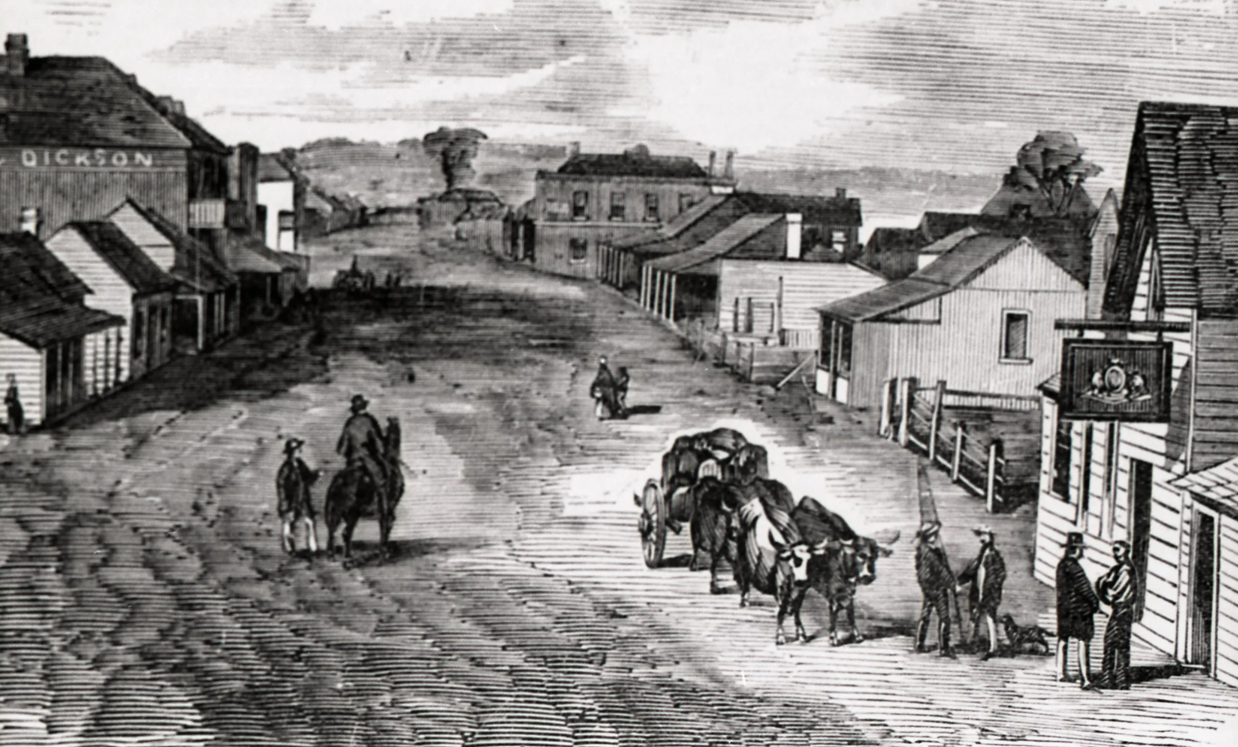
View of High St, West Maitland, Illustrated Sydney News, 31 March 1855
Between the Port and Hunter St, a distance of 400 yards (about 366 metres), the track soon became lined with buildings. There were inns, blacksmiths, saddleries and all manner of shops. This was the area of Maitland’s original Central Business District. Other buildings, also serving those who passed through as well as the growing number of local residents, straggled along High St north and south of this cluster.

Detail from John Turner’s plan of Maitland, circa 1840
This section of the plan shows the central business district of the time. David Cohen’s store is located near what was referred to as the Port of Maitland. This bend in the river disappeared following the 1893 flood. It is now Smyth Field.
(The full plan is published in John Turner, The Rise of High Street, 1989, p. 6.)
Improvements
The track initially was more undulating than it is now. Natural depressions in the ground became tiny creeks which took flows to the river after rain and, when flooding occurred, allowed river water onto the floodplain. These depressions were often boggy and difficult to traverse. Gradually, they were filled in and some were piped to the river: one was on the alignment of Free Church St. There were others, whose ancient paths correspond to the manholes over the turncocks which can be seen today on the riverbank.


High St, Maitland, 1868
(Hunter Photobank 056 000283 and 056 000288)
The photographs show the wet, muddy surface of the street. A timber footpath can be seen in the photograph on the left - although there is a horse on the footpath!
High St, for decades vital to the developing inland, remained muddy for many years. Eventually it was gravelled and, much later, hard-topped. It was probably the first street in Maitland to be sealed. Timber footpaths were created for ease of pedestrian movement, and troughs were constructed for bullocks and horses to drink from.
Eventually, to alleviate the nuisance and congestion they caused, the bullock trains heading up and down the valley (carrying wool from the interior and various supplies in the opposite direction) were directed to the south of the CBD and across Trappaud Bridge. Something similar happened much later, in the early 1980s, when Les Darcy Drive came into being and took through traffic (much of it heavy vehicles) away from High St. The amenity to shoppers and others in the CBD was much improved. The street had never been well suited to large trucks, though many of them passed through.


Views of High St, Maitland, early to mid 20th century
(Hunter Photobank and Picture Maitland)
Well before Les Darcy Drive, Maitland’s main thoroughfare saw its first cars and, between 1909 and 1926, trams. The main retail section of the street became a mall during the mid-1980s and in 2015 the section between Bourke St and Elgin St was converted to a ‘shared zone’ for vehicles as well as pedestrians. In 2018 High St was connected to the Riverside Walk. Considerable sums of money obtained from the federal government were invested in improving the amenity of High St in recent times.
References
Keys, Chas and Short, Kevin, ‘Our past: the origins of High St, Maitland’, Maitland Mercury, 20 April 2020.
Turner, John, The Rise of High St, Maitland: a pictorial history, second edition, Council of the City of Maitland, Maitland, 1989.